Tuesday, September 24, 2013

Delaware Bay to the Chesapeake


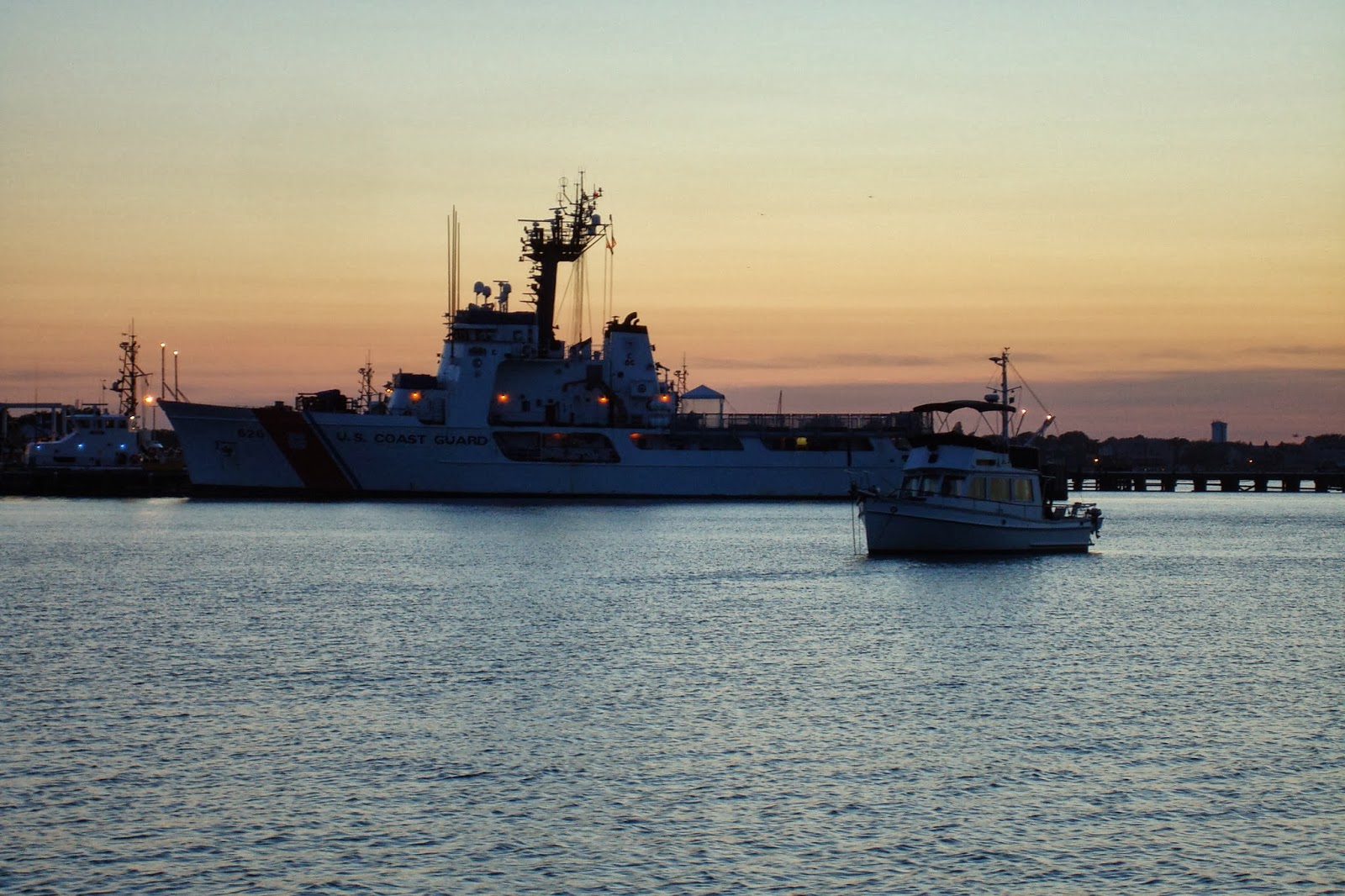
Saturday, Sept 21 -- The Cape May Coast Guard Training Center bootcamp recruits were quiet at 7 a.m. as we slipped out of the harbor, bound for the Cohansey River in Delaware Bay -- perhaps they get to sleep in on Saturdays!

As we began heading up Delaware Bay, a veritable parade of tankers was heading down the bay -- seven, in fact.  Happily, they were traveling a fair distance from us -- but that means the photos are distant, too.  Below are a couple of them:
Tankers in Delaware Bay
 And below, if you squint, you can see a line of four, starting with the second one in the photo above:
Line of tankers going southeast in Delaware Bay
As the tankers were streaming by, we came to a Racon buoy -- a buoy that sends out a radar signal.  The wind was light and we were motoring (in spite of predicted strong winds -- again), so we had the juice to spin up the radar for fun.  Below you can see the signal from the Racon buoy -- three shorts and a long -- as well as the line of tankers (the yellow blobs):

Racon buoy and tankers in Delaware Bay
About an hour later, we came to another Racon buoy, with a different signal, two shorts.  You can also see the tankers, behind us now:

Another Racon buoy
About mid-day the wind freshened out of the southeast, to 10 knots.  This was straight behind us, so we pulled out the sails and went "wing-on-wing" -- namely, the main out horizontally to port (left) and the jib out horizontally to starboard (right).  Below is how it looks from the cockpit of the boat:

 'Wing on wing', sailing up Delaware Bay

Wing On Wing is such a glorious way of sailing, and also on account of the initials, we note it as "WOW" in the log.  In the photo, you can see the "whisker pole" on the jib, holding it out to starboard. The jib is quite large and thus heavy, and the whisker pole helps keep it out horizontal.  You can't see it in the photo, but we also put a "preventer" on the main -- a line preventing the main from swinging across to the other side, should the wind get too light to hold it out, or shift around and back-wind the main.  

We had a glorious (WOW!) sail up the bay.  We did at one point encounter a powerboat careening toward us, into our side of the channel and crowding us out of the channel where there were shoals on the side.  We (Dorothy) blew the air horn, long and loud, and it corrected course.  

By 2:00, we were nearly to Ship John Shoal, marking our turn into the Cohansey River:

 Delaware Bay, "Ship John Shoal"

Dorothy took the whisker pole down (Fred had put it up!) and rolled in the jib.  After we went around the Ship John Shoal mark, we headed into the wind (weaving between lots of crab pots) and brought in the main as well.  We had to be careful with depths, so motored in from here.  The Cohansey River terrain was comprised of beautiful marsh grasses:

 Cohansey River

The water was quite "lively," with the tide going out and about 1.7 knots current against us:

 Ebb tide, 1.7 knots,  Cohansey River

The river meandered, back and forth, and on the inside meanders, there was shoaling too shallow to pass.  On the outside meanders, the depth was sometimes over 60 feet!!  Fred deftly navigated up the river, about 3 miles, to where we anchored, right in the middle of the river, and hunkered down for rain and gusty winds up to 20 knots predicted overnight.  We got some rain and wind, and eventually it died down.  In the wee hours, we heard a great horned owl!  How often do you hear that when anchored!!

Sunday, Sept 22 -- In the morning, Dorothy navigated us back out.  At that time, the tide was ebbing -- current in our favor -- and was nearing slack tide.  The water had already dropped several feet, and the marsh grasses now stood on top of piles of dirt, one to two feet out of the water, all in all presenting a very different picture than on the way in:

Cohansey River marshes, near low tide
The wind had come around to the north overnight as the front came through, and was now straight on the nose.  We could not tack back and forth as we were traveling in a very narrow channel, so again, we were motoring, even though there was a vigorous 15 knots of wind!

As we continued making our way up Delaware Bay, we looked behind us and saw:

 A tanker sneaks up on us from astern

We left him plenty of room, and soon he was beside us:

 Tanker, probably bound for Wilmington or Philadelphia

And then leaving us behind:

Tanker overtakes us in short order
Below is another ship, passing us the other direction:

Another ship passing, bound for sea
Another sight along the way:

The Salem Nuclear Power plant dominates Delaware Bay

Salem nuclear power plant
By late morning, we came to the C&D (Chesapeake and Delaware) Canal, and turned on in.  The canal is quite beautiful, lined with stone and trees.  Below are a few sights along the way:

 Conrail Lift bridge, Chesapeake & Delaware Canal

 A natural gas pipeline aerial crossing

 In Chesapeake City -- 'boat-up' restaurant service

At last we reached the Chesapeake Bay, and now we could really sail.  So often, we have motored much of the day, then sailed near the end -- it lets us end the day with a great feeling!

 At last the Chesapeake - -lined with estates and rolling terrain

We turned into the Sassafras River to anchor for the night.  Fred's father had sailed there in the 1940's, and told Fred it was beautiful.  Indeed it was!  High bluffs, red soil.  Great blue herons, and Canada geese!
 Sassafras River

Our anchorage
Sunset on the Sassafras River
And our last seven days, ending at the Sassafras River:

Last seven days of locations, up to Sassafras River, Chesapeake Bay
A good time to say good night!

Monday, September 23, 2013

Cape May!!

Wednesday, Sept 18 -- We arrived in Cape May mid-day after our first duo overnight passage, and anchored near the Coast Guard Training Center in 10 feet of water.  The tidal range here was about 6 feet, so we put out anchor chain for 16 feet -- about 120 feet.  After anchoring, Dorothy took a nap and Fred went out to refill an empty propane tank at a Shell station.  In the late afternoon, the boat had swung completely around, and we thought we might be too close to the catamaran that had been behind us, and was now in front of us.  Turned out it was OK.  Yeah!

Fred had discovered a seafood market, so we dinghied over to it and bought scallops and rock fish.  We had pesto scallops over linguini for dinner (pesto from home!), with enough left over for a second night, and froze the fish.

A week or so ago, I signed up for Daily Challenge at challenge.youmehealth.com, and my challenge for Sept 18 was to:

Stop and take a moment to enjoy a sight, sound, or smell.


Here is what I did for the challenge:

I went above decks to soak in the surroundings of tonight's anchorage. The air is crisp and cool, but calm, and the water in the bay appears still and smooth as glass. And yet, the boats are all pointing west, and by the light of the harvest moon, you can see the reason: the steady current quietly draining the bay, as the tide is going out. Every light around the bay has a pencil-like reflection in the water, each resembling an upside-down exclamation point, or a taproot down into the water. A steady chorus of crickets forms a backdrop for the occasional bird call.

Here is what I saw that night:

Lights reflected on the water at our Cape May anchorage at night.

Thursday, Sept 19 -- We had decided to take a "down" day today and explore Cape May.  When we bought the boat, the seller sold us two folding bikes.  We packed those up and dinghied to the public boat launch, tied up there, and rode the bikes to town.  Fred's bike had two broken spokes on the front tire.  Turns out biking is big in Cape May, and there is a bike shop right downtown.  Fred left his bike there for repair.  During the hour-and-a-half we had to kill, we split up to wander around separately.  Dorothy headed straight for Beach Avenue and the beach:

 Surfer at Cape May beach

I had worn long pants, but I rolled them up and went in up to my knees, anyway!  The water was cold enough to feel refreshing, but not too bad, really!  Fred poked around in the shops and found a few more kitchen gadgets.  Cape May has a very pleasant pedestrian mall much like Church Street in Burlington.  Here is Fred on the mall:

Cape May Washington St Pedestrian Mall
After a bite of lunch, we picked up the bikes and rode a few miles out to the Cape May Bird Observatory, where Dorothy bought a new pair of binoculars, as well as two bird field guides, then on to Cape May Point State Park, where the Cape May lighthouse is located -- 157 feet tall and built in 1859.  Here is Dorothy using the new binoculars to view a couple of peeps at a pond along the nature trail:

 Dorothy birdwatching at Cape May lighthouse / state park

As we rode home, we encountered a huge hardware store.  Fred is to hardware stores as Dorothy is to quilt or yarn shops.  Unfortunately, whereas Fred was in luck that the yarn shop in Oyster Bay was closed, Dorothy was not so lucky -- the hardware store was open!  Sigh.

 Huge hardware store OPEN

At last we got back to the dinghy.  Unfortunately, Fred's rear tire now broke a spoke.  Still, it was a lovely day, and we headed back to the boat for leftover scallops.

Did we mention the Coast Guard Training Center?  In fact, their website, http://www.uscg.mil/hq/capemay/, has a nicer picture of our anchorage than I could ever get:

USCG Cape May Training Center AND our anchorage
Toward the top of the photo is the inlet from the ocean to the harbor, where we came in from our passage on Wednesday.  See the coast guard vessel?  We were anchored between the inlet and the coast guard vessel.  We could hear the Coast Guard Boot Camp recruits' cadences beginning at 5:30 a.m. and going well into the evening.  In fact, I see there is a cadence contest going on this week!  Check it out and vote for your favorite cadence!  http://bootcamp.coastguard.dodlive.mil/2013/09/21/its-time-for-cadence-contest-2013/

Friday, Sept 20 -- We thought we had an anchor issue because our anchor chain was leading back toward the boat rather than forward, even at the height of the ebb and flood currents, so we thought we'd better tackle that first thing.  We figured out pretty quickly that the anchor chain was fine, perhaps just in a pile.  We then discovered that we definitely had a problem with our forward head holding tank, which was leaking.  I maintain that EW is a word, even if Words With Friends doesn't think so, and the meaning of it is, "how holding tanks smell when they are leaking"!!!  We will spare you the photos in this case, but we worked on the holding tank about half the day and resolved the leak problem.  Another successful repair!!

Now on to the bicycle spoke!  We packed up the bikes into the dinghy again, dinghied to Utsch Marina this time, biked into town again, and left Fred's bike at the bike shop again.  It was deja vu all over again!  This time I dragged Fred to the beach, where he took an artsy shot of the pattern made by water in the sand:

 Beach at Cape May

as well as one of me:
Dorothy in the surf
Woo hoo!  Did I mention I love the ocean?!?!?

When we picked up our bikes, our friendly bicycle repair man took our picture:

 Our folding bikes, unfolded (broken spokes replaced)

So we took his picture, too:

Cape May Bicycle Repair rocks!

Riding back to the dinghy, Fred noted the beautiful streets lined with sycamore trees:

Beautiful tree-lined and tree-canopied streets
The trees are a priority, even though they do lean into the street
It would not do to fail to mention the many, many beautiful Victorian houses in Cape May, of which this is but one example:  

Victorian House in Cape May
Finally, back at the boat before sunset, our last evening at Cape May:

 Cape May Coast Guard Training center,  the USCG cutter Dependable

And so ends our visit to Cape May!

Sunday, September 22, 2013

Our first duo passage

Tuesday, Sept 17 - Wednesday, Sept 18 -- Since the stopping points within a day's sail looked too shallow or too risky to get into, we decided to go from Sandy Hook to Cape May via an overnight passage.  We had a relaxing morning, delaying our departure due to a small craft advisory forecasting wind gusts to 25-30 knots and 4-6 foot waves.  In preparation, in addition to putting the dinghy on the foredeck (previous post), we planned our course -- generally how far offshore we would go (3-5 miles), then our bearing, distance, and marks for each segment; got out our offshore PFDs and tethers (straps that we clip one end onto our PFD and the other end to a pad-eye on the boat); put out our jacklines (webbing straps along the deck that we would clip our tethers onto if we needed to go on deck at night); and planned our watches, as follows:

2-5 pm Dorothy
5-8 pm Fred
8-11 pm Dorothy
11 pm - 2 am Fred
2-5 am Dorothy
5-8 am Fred
8-11 am Dorothy
11 am - 2 pm Fred

 Jack lines (yellow webbing)

Since we had to wait for the weather to calm down a bit anyway (little did we know just how much it was calming down), we had breakfast in style:


Fried eggs in toast and mangos!

Fried egg in toast Anneke-style

Finally, we pulled up our anchor and headed out at 2:00 pm.  There was quite a chop around Sandy Hook, and the marked channel went astonishingly close to the beach.  In the photo below, we were in 60' of water, and very close to the beach.  The water was like a washing machine.

 Sandy Hook, NJ

We had abundant wind going around Sandy Hook, but it was straight on the nose, so we motored that part.  When we turned south, however, the wind completely died!  When we listened to the weather radio, we learned that the small craft advisory had been extended!  We were mystified as to where that 15-20 knot wind with gusts to 25 knots was, but we were committed at this point, so we motored on. 

Afternoon turned to evening, and we had a beautiful sunset and moon rise.  A kind of calm comes over the water as the sun sets -- you can almost feel it in this photo:

 Moon rise off Manasquan Inlet

Of course, that calm feeling may partly be because there was no wind, so it WAS calm!  We motored on.  And on.  And on!

After midnight, Fred saw the neon of Atlantic City.  As Dorothy's 2 am watch began, it appeared there was enough wind to sail, so we rolled out the main and Fred rigged a preventer before going to bed.  In an hour or so, the wind dropped to under 5 knots, just not enough to carry the sail.  The motion of the waves caused the main to flog (repeatedly lose its air, then slam), so we had to get the preventer off and bring the sail in.  Since this is an on-deck job, Dorothy had to wake Fred up (sorry, Fred!).  About an hour later the wind freshened from the north, a steady 10 knot wind, so Dorothy pulled the main back out and was able to cut the engine.  This time it lasted.  Finally -- that beautiful, calm, silent gliding through the water that makes an overnight passage almost magical.  The reflection on the water of the almost-full moon added to the ambiance as well:

 moonlit passage

Several folks we discussed routes with had suggested we stop in Atlantic City, but we decided to pass, as it does not really appeal to us.  Still, you can't miss it -- it was visible for hours and hours, from about midnight until near dawn.  

 Atlantic City, 3:20 a.m.

 Looking back at Atlantic City, 5:05 Am

Since Fred stayed up past the end of his watch to help with sails, and had to get up in the middle of his 3-hour rest, Dorothy extended her watch to 7 am (thereby getting to see the dawn!).  Then Fred took over again.  We arrived at Cape May about mid-day.  Fred went exploring and Dorothy went to bed!  But our Cape May adventures will be described further in our next post!!

Wednesday, September 18, 2013

Through Hell (Gate) Together

Monday, Sept 16, 2013 -- We woke up this morning with a great feeling of anticipation.  Hell Gate Day!  Hell Gate is a narrow tidal strait in the East River in NYC, where the current can be quite strong.  For us, southbound, we would be traveling the chart segment below from upper right to lower left.  You come under a railroad bridge and the Triborough Bridge, then bear right and then left, keeping Mill Rock (that frying pan shape in the water) to starboard (right), then staying to the right around Roosevelt Island:

Hell Gate

You certainly don't want to be traveling against the current in Hell Gate, and as for being with it at peak flow, people have described it as like driving on black ice.  Here is a youtube video to give you an idea what the water can be like:
http://www.youtube.com/watch?v=58jLwiBYI20

Most recommendations are to hit Hell Gate at slack water turning to ebb, which provides current in your favor all the way through NYC and south past the Verrazano Narrows Bridge.  For us that meant hitting Hell Gate at about 7:53 am, very manageable, and riding the current all the way to Sandy Hook, taking pictures of NYC sights along the way.  Never mind a little drizzle!!

We were both thrilled that the engine started.  For me, this was reminiscent of when I was a little girl, and got strep throat over and over again.  Each time I took antibiotics and the agony of swallowing abated, I was so filled with joy that I could simply swallow without pain.  Fred and I are still in that stage with the engine starting!!  Losing and recovering something you otherwise take for granted is sure a reminder that seemingly little things are really amazingly awesome.

Anyway ... here was an early view of NYC.  It was exciting seeing the skyline, but we also had to keep focused on the close-at-hand, as exemplified by this ship going the other direction.

View of NYC Skyline

Soon things started to get quite busy.  Planes were landing and taking off over our heads to/from LaGuardia airport.  Barges and ships were on the move.

Plane landing at LaGuardia.  I missed one that went RIGHT over us.

Share the road -- you betcha!

Riker's condominium complex, occupancy by invitation only.

Our traversal through the Gate was without incident.  BTW we did NOT put up sail -- we motored through, for maximum maneuverability.  After we traversed the Gate, Fred took the helm so I could take photos.

Along East Side Hwy, we were moving faster than the cars at times.

Park on south end of Roosevelt Island.

United Nations building.

Fred at the helm in NYC.

After Hell Gate and up to the Statue of Liberty, the water was abuzz with fast-moving ferries of various sizes (but all much bigger than us!).  Their mission is getting across the river in a hurry, and you'd best stay out of their way.  Fred did a great job!  Here is the front of one, and also a helicopter landing at the hospital.  Emergency medical rescue?  Nope, delivering execs.  We saw four helicopters land there during the time it took us to traverse that area.

Helicopters and ferries -- busy busy!

This is a photo of the Staten Island Ferry going in the same direction we were, a fairly relaxed scenario.  I'm afraid I did not get any photos of the ones coming straight at us!

Watch out for the fast-moving and very large Staten Island Ferry!

Ellis Island Immigration Museum

Lady Liberty herself

I have been to the Statue of Liberty, but sailing by her was an incredible experience!  Shortly after this, I took the helm again, taking us under the Verrazano Narrows Bridge and down to Atlantic Highlands, at the base of Sandy Hook.

Going under the Verrazano Narrows Bridge

Below is a ship we passed en route.  Those are tractor trailer containers, which is an indication of the size of this ship.

More sharing the road.  

As we got close to our destination for the day, Atlantic Highlands, at the base of Sandy Hook, we saw this fishing boat with a sail deployed in an interesting way.  We'd not seen this before.  There were two such boats there.

Fishing boat with sail.

After anchoring, we went to work on the GPS, our outstanding critical issue.  We have a hand-held GPS, but without the boat's GPS feeding to the other systems, we have no auto-pilot, chart plotter, true wind speed, or speed over ground (this meant that we did not know, as we traversed Hell Gate and the East River, how much of a speed boost we got due to the current). 

Fred in an aft lazarette trouble-shooting.

Fred had made a call to a local Raymarine certified repair technician, but had not heard back.  We had tried a number of things, unsuccessfully, and were considering whether we could make an overnight offshore passage without autopilot.  In the late afternoon, we got a callback, and Kemal Goksel took the marina launch out to us, with a few tools, working autopilot, and a meter.  Kemal had had surgery on Thursday on severed fingers, and bore enormous bandages.  He was supposed to be taking it easy.  Still, he hoped he could help.  He knew Seatalk systems backwards and forwards.  In fact, we learned that he additionally has a PhD in electrical engineering!!  He found that the GPS signal was coming out of the GPS unit fine, so another component had to be corrupting the signal.  Soon he found the culprit, the resolution of which was to remove and reattach the connections.  We went ahead and did that for all the instruments.  Now we have GPS going to all the instruments as it should -- and like with the engine starting, we are euphoric to have have our electronics working!!!  We recommend Kemal Goksel (732-291-3199) to anyone with a Raymarine / Seatalk issue -- he knows his stuff!!!  

Kemal Goksel heading off into the sunset after resolving our GPS issue.

Sunset at Atlantic Highlands, Sandy Hook

Here are our last 7 days of travel up to the present:

Spot messenger, last 7 days

You can look at the last 7 days of Spot messages yourself, anytime, at the following link:  http://share.findmespot.com/shared/faces/viewspots.jsp?glId=0pjBgdOoUaGM0ecc8yG2gxG0gE9D5nNi9

Tuesday, September 17 -- As soon as Kemal left last night, we re-stowed the hogged-out lazarettes, then moved the dinghy from the davits to the foredeck, in preparation for an overnight passage to Cape May.  Doing that in the dark was better than in the heavier winds (small craft advisory) predicted for this morning.  Here is how the dinghy gets secured for passage:

Dinghy engine on engine mount

Dinghy on the foredeck

Writing at about noon, we are planning a 2 pm departure for an approximately 23-hour passage to Cape May.  We have been watching the weather carefully, and have held off leaving for conditions to moderate.  We should arrive in Cape May mid-day tomorrow.  We'll keep you posted!

PS I was unable to post this on Tuesday before heading out, and now we are actually in Cape May!  More on the passage in the next blog post!