-- We got an early start out of Elizabeth City, bound for the town of Manteo on Roanoke Island in the Outer Banks. We wanted to have some time to see Manteo in the afternoon, as we knew we had to keep moving the next day. We were eyeing an approaching cold front and hoping to make a circuit through the Outer Banks and down to to Ocracoke before it came through.
 |
Sailing into the dawn, from Elizabeth City into Albermarle Sound
Fred liked the, uh, symmetry of this photo:
|
 |
Another boat sailing out of Elizabeth City, into Albemarle Sound
Now you can see what the sailboat was partially obscuring ...
 |
| Giagundo blimp hangar |
We got to Manteo Island in the early afternoon on OBX (Outer Banks) Marathon day -- reminding us of the marathon Dorothy's daughter Sage and her fiancé Sam were running in Philadelphia the following weekend. Half-marathon runners were strolling the docks and marathon runners were still coming in. Fred settled down to blog-writing while Dorothy decided to bike to the North Carolina Aquarium about 4 miles away.
|
 |
| Dorothy's bike on bike path toward aquarium |
The large, eel-like animal below is actually a salamander. You can see its front legs (no back legs). Amazing!
 |
| Eel-like salamander |
The aquarium has a ray petting tank. The rays went round and round the tank. You can see several below.
 |
| You don't often get to see the underside of a ray! |
The unusual fish below was also in the ray petting tank:
 |
| Guitar fish in the ray petting tank |
Jim Cole, Joy Hampton's fiancé, told us that he cleans the shark tank on Wednesdays. An aquarium staff person said they clean the tanks twice a day. Wow! They pointed out that there is a lot of intake, and therefore a lot of output in the tanks!
 |
| Sand tiger shark, largest shark in the shark tank |
On the boat we are trying to be conservative in acquisitions and expenditures, but the aquarium had the greatest gift shop! But we have to learn how to cook some of our favorite seafoods and better understand beaches, right??
 |
| Souvenirs of the North Carolina Aquarium |
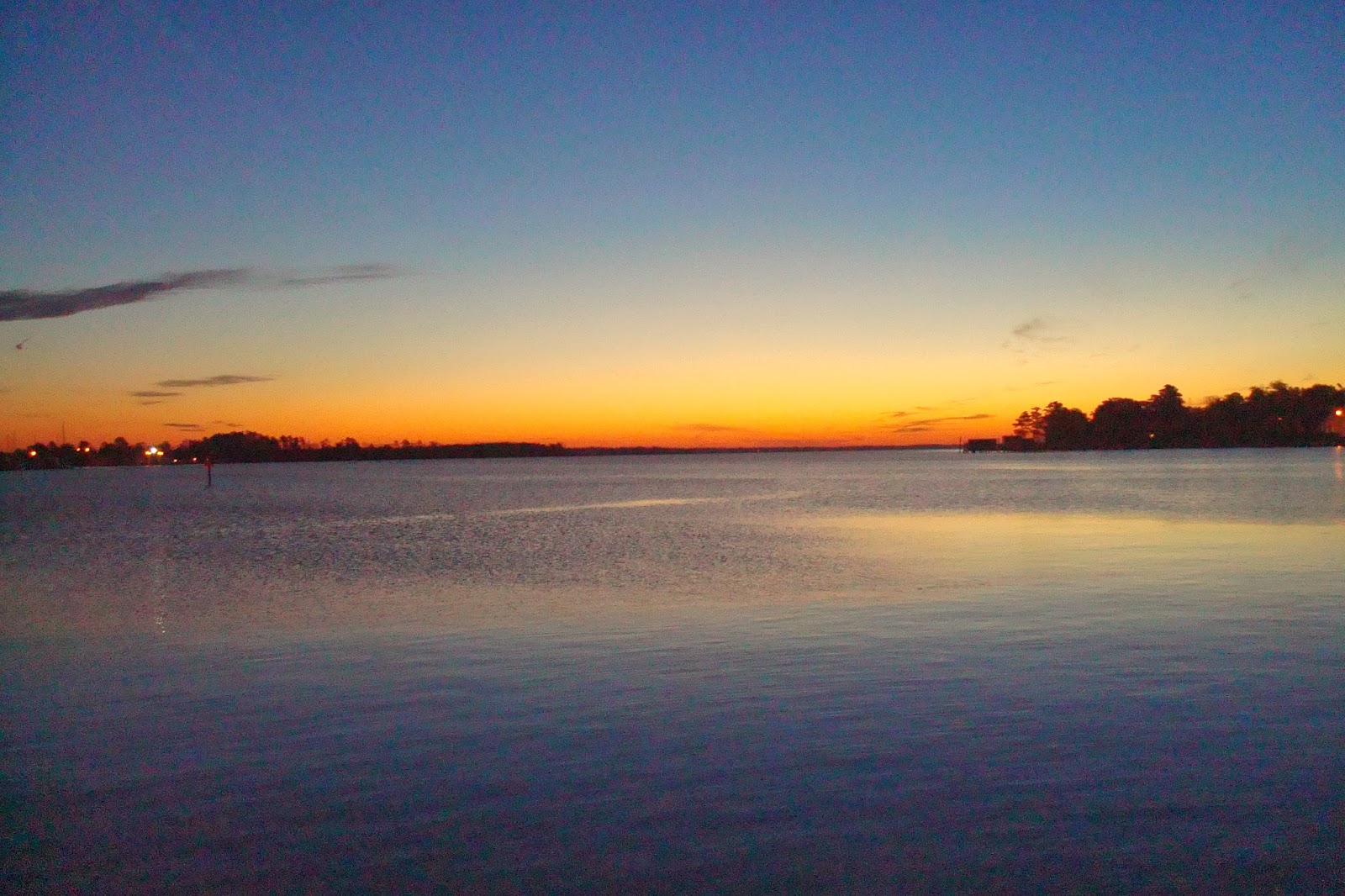
Back to the boat, barely before dark:
 |
| Sunset in Manteo, just inside the Outer Banks |
Monday, November 11 -- We had planned to continue on to Ocracoke today, but the forecast for an approaching cold front had increased in intensity and accelerated in timing such that we were not sure we could get away from Ocracoke before gale force winds hit on Tuesday. Much as we hated to, we decided it would be safest if we retreated from the Outer Banks back to the ICW -- from gale exposure to the safety of the Alligator River (tee hee)!
We headed back out to Albermarle Sound, and then into the Alligator River, soon reaching the Alligator River Swing Bridge. Those of you who know Dorothy may know that she does not care for Walmart because of the obscene wealth accumulated while underpaying employees, as well as the price undercutting that puts neighborhood stores out of business. She could not help taking some small pleasure in holding up a Walmart truck while the swing bridge opened for us.
 |
| Slowing the unrelenting march of Walmart by 10 minutes |
The swing bridge itself is fascinating:
 |
| Alligator River swing bridge |
Once through the bridge, the wind was abaft and light, about 5 knots -- perfect for a spinnaker run!
 |
| Spinnaker run down the Alligator River |
Fred deployed the spinnaker and Dorothy snuffed and stuffed this time ... next time we will reverse, in support of our mutual goal of broadening our skill sets and both being fully capable on the boat.
 |
| Dorothy stuffs the spinnaker |
As the spinnaker was stuffed, the Alligator River - Pungo River Canal came into view, and in we went ... we were down to the wire to make it to the Pungo River, where we planned to anchor, before dark.
 |
| Entrance to the Alligator River - Pungo River Canal |
 |
| Alligator River - Pungo River Canal |
Anchor we did, in the same lovely spot we anchored in when we brought the boat from Florida to Rhode Island in May... below is the serenity of the sun set, belying the gale forecast for the next day.
 |
| Sunset anchorage at the headwaters of the mighty(?) Pungo River, near Belhaven |
Tuesday, November 12 -- We had a long way to go to reach Morehead City ahead of the forecast cold front with gale force winds -- gale warnings for 4 pm -- so we got up before daylight and got an early start.
 |
| Sunrise at the Pungo River with morning mist, as we get going early |
We can't complain much about the cold as most of you, our dear readers, are experiencing much colder winter temperatures now ... but it was chilly! As the cold front approached, the wind clocked around ... from the SW until 11 am, then the W ... we were watching for the shift to the N and the sharp increase in wind velocity that would come with the front.
 |
| Chilly Dorothy |
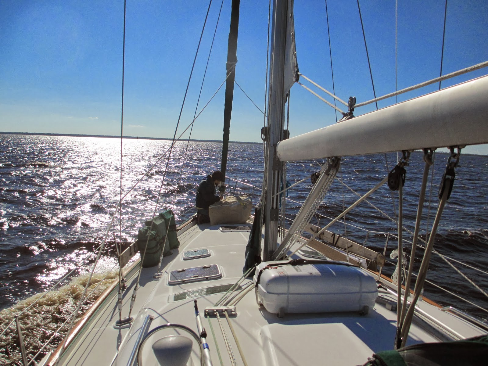
The route was a mix of motoring and full sail, depending on whether we were in a sound or wide river, or narrow canal. In spite of the fact that we were racing against the weather, we had some lovely sailing!
 |
| Parallel tell tails on our jib let us know the sail set is just right |
 |
| Another cruiser headed southbound across Pamlico Sound. They passed us, but they were power-sailing! |
As we came down the Bay River toward the Neuse River, we were reaching a go/nogo point -- the Maw Point Shoal. If conditions had deteriorated there, we would fall back. Otherwise, we would go forward, with a couple other bailout points still available. We reached Maw Point Shoal at 1130, and the wind was W 14 kts at that point -- still OK. Onward into the Neuse River! By 1240, the wind shifted to NW and intensified to 14-18 kts. One of the two boats in front of us peeled off, likely bound for hunkering down in Broad Creek, on the north side of the Neuse River. Shortly, the other boat ahead of us peeled off as well, heading for Oriental. On we went!
 |
| A barge in the Neuse River (pronounced 'noose' river down heah...) |
By 1330 we were across the Neuse River and had entered Adams Creek. Very shortly we heard on the weather radio that the gale warning was already in effect in Beaufort -- three hours earlier than the morning's forecast. By 1430 the wind had turned sharply to the N and picked up to 20 knots. We were going due south, motoring, with the wind on our stern, blowing our flag straight into the cockpit.
 |
| Giant ship crane in Morehead City, NC |
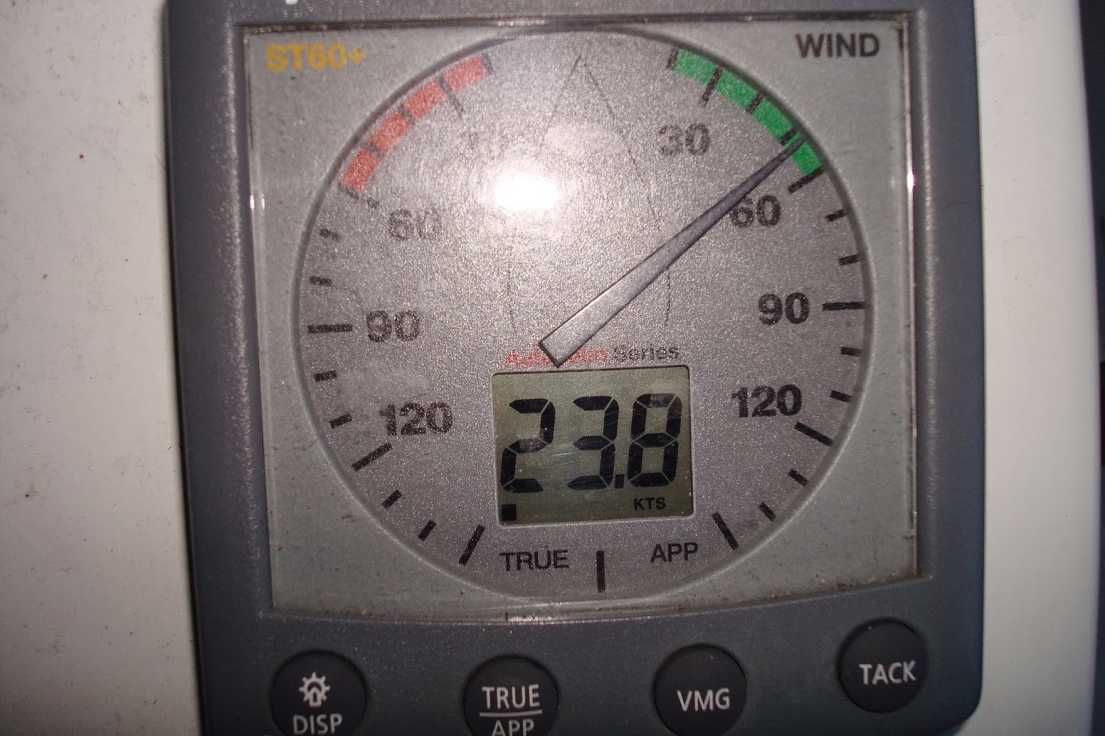
Onward, onward, through the Adams Creek Canal and then along the edge of the much wider Newport River, quite "lively" with the heavy winds. Then just around a few bends and into the Morehead City Docks, where dockhand Ed kindly helped us into our slip. By then the wind was 25 knots. PHEW! That was a little closer than we'd like, but Morehead City/Beaufort is where we wanted to be, and we made it!
 |
| Wind speed after docking in Morehead City |
Being in a slip meant we would have shore power, which in turn meant we could run our little space heater. The temperatures had dropped sharply ... we had sleet overnight. The next day was freezing cold and very windy -- we were happy to be snugged in. Dinner at Mythos Waterfront Grill, right on the waterfront ... highly recommended!
 |
| Our slip at the Morehead City Docks |
We stayed through the next day (Wednesday) while the wind continued to blow. We had ordered a portable drill with rechargeable batteries, which was waiting for us at the Beaufort PO. Fred took a taxi because bicycling on the highway bridge over the Newport River in 25 knot winds with no helmet just didn't seem wise. Fred rewarded himself with a visit to the excellent Ace marine store in Morehead City. Dorothy did laundry, and rewarded herself with a visit to the quilt shop!!
Fred had an interesting pedestrian experience:
 |
| The main drag in Morehead City - - notice the freight train coming down the middle of the street... |
 |
| Freight train stopped for about 30 minutes in the middle of the street - -making left turns a bit of a wait... |
 |
And leaving this pedestrian wanting to cross with the prospect of hopping over the
train cars - - and really hoping the train doesn't start up just then...it didn't... |
After a cold front passes is a good time to head south, riding the remnants of the NE. We planned to take advantage of that the next day, and enjoy a coastal day sail to Wrightsville Beach.
Thursday, Nov 14 -- From Morehead City to Wrightsville Beach, NC
The wind was uncooperative ... 5 knots ... we'd try to sail, then have to motor, then try again ... oh well. About 10:30, Fred gave a shout -- he saw a dolphin leap completely out of the water! It was one of a LARGE pod of dolphins, some of which came and swam at our bow -- "bowriding" is a common dolphin behavior -- so exciting! They come to the surface and tip to the side -- they appear to be looking up, trying to see what's up there. You can see the edge of our anchor in the photos below, showing how close to the boat they were. These dolphins were very speckled -- they appear to be Atlantic Spotted Dolphins, which are also known for their acrobatics.
 |
| Atlantic spotted dolphins "bowriding" |
 |
| See the tiny one? A baby! |
That was the big excitement for the day ... other than that it was very quiet! A great time for a nap!
 |
| Fred snoozing |
Around 3:30, not only was there still not enough wind to sail, but the ocean became a glassy sea, so smooth it was almost eery:
 |
| Glassy sea |
We came to the Masonboro Inlet to Wrightsville Beach just as the sun was setting. Below is the jetty, with waves crashing over it ... always a little unnerving.
 |
| Masonboro Inlet jetty |
The sunset was lovely ...
 |
| Sunset in Masonboro Inlet |
We anchored in a jiffy and called Lindy Bird, who lives nearby, and grabbed a bite to eat at Tower 7 Baja Grill (Mexican). Lindy was amazing, and took us all over town grocery-shopping -- Trader Joe's, Whole Foods, and Harris Teeter!! Thank you, Lindy! What a lovely day!
Friday, Nov 15 -- Wrightsville Beach to Little River, SC
The plan today was a mix of ICW and coastal sailing. The Frying Pan Shoal between Wrightsville Beach and Cape Fear sticks out so far that we didn't want to go all the way around it. Instead, we could cut behind it by taking the ICW down to Cape Fear, then going out. We encountered some amazing currents as we traversed this stretch during ebb tide. We passed a number of inlets, and each time, since the waters were flowing out the inlet to sea, the current was in our favor as we approached the inlet, then against us after we passed the inlet. Finally, once we were on the Cape Fear River, which flows out the Cape Fear Inlet, the current was like Hell Gate in NYC. See below our "speed over water," or speed relative to the water, of 5.7 knots:
 |
| Speed relative to the water = 5.7 knots |
At the same time, our VHF showed a SOG (speed over ground) of 9.1 knots, a "push" due to the tidal current of 3.4 knots!! In fact, we got as high as 10.1 knots!!!
We had a generally nice sail down to Little River ... a broad reach in about 15 knots out of the ENE, jib only. By around 3:00 the waves had gotten big enough that the jib was not sustainable, so we rolled it up and motored the rest of the way.
Below is a good look at one of the many fishing boats we've seen, with long arms extending out each side, off of which their nets hang:
 |
| Typical fishing boat |
Here was an amusing buoy ... probably a weather buoy:
 |
| R2D2 |
The waves breaking in the Little River Inlet, with the waves a'rockin', were enough to make your hair stand on end (haha!):
 |
| Little River Inlet, waves breaking on the jetty |
Overnight in Calabash Creek, near the town of Little River.
Saturday-Sunday, Nov 16-17 -- Overnight Passage from Little River to Charleston
We decided we'd do another overnight passage, our first and only so far this fall being from Sandy Hook to Cape May, NJ. We gassed up at Cricket Cove Marina in Little River, but no pump-out available, to our dismay, and headed out around mid-day -- we did not want to head out too early, lest we arrive in Charleston before daylight. It was a BEAUTIFUL day! We had been so cold for so long, it was a huge treat!!
 |
| Captain Fred -- a warm day for a change -- shorts! |
Not only was it warm, we got to see some sand! We have actually been swimming not at all (Fred) or once (Dorothy), and we have been on one beach so far (Cape May). We are very eager for warmth -- warm air, warm water, warm sand!!! In any case ... we sailed past the sand below!
 |
| Little River Inlet -- sand!! |
As we got well outside the 3-mile line and our holding tanks were nearly full, we decided to try macerating. No luck -- nothing came out of either head's macerator! They had worked before ... what could it be?? Another boat project!
Looking at the log for this overnight, it reads like so: sails out, can't carry sails, engine on, sails out, engine off, slatting, engine on, furled jib, motoring, motoring, motoring, motoring. Sigh. Sometimes passages are more idyllic than others! It was a beautiful sunset, though!
 |
| Sunset off North Carolina coast |
 |
| Moonrise |
To cap off a night of sleep-deprived motoring, as we were preparing to head into Charleston in the morning, the main sail jammed (would not roll out of the mast), and we drove around in circles pulling it in, out, down, slatting, and everything else, until we got it unjammed, but we did get it cleared!
We entered Charleston on the Ashley River side, and anchored, but as we swung around, we were too close to another boat. Since the depth in the anchorage was 30' (requiring a lot of chain), the anchorage was crowded, heavy winds were coming the next day, no slips were available, AND there was no pump-out to be had in the area, we decided to go over to the Cooper River side where we could get a pump-out and a reservation for the next night when the winds were to be heavy. There, we got a pump-out at Charleston Maritime Center, and ended up staying there that night, too.
Charleston ... well, that will be the subject of the next blog entry!
BTW we passed the 1000 nautical mile mark on the passage from Morehead City to Wrightsville Beach!!! Remember, this is at a speed of around 6 mph!!!