Thursday, September 18, 2014

Back to our Aviva Home

After a wonderful summer at camp and a couple of weeks at home due to a gap between house tenants, on September 11 we moved back aboard s/v Aviva for another 9 month stint of living aboard and traveling.  We have been busy preparing the boat and ourselves, particularly for the 7-12 day passage we will be making to the British Virgin Islands in November.  But ... we'll get to that, all in good time.

Here is the inside of s/v Aviva the evening of September 11, after we put the cushions back on, re-covered the bilge, closed cabinet doors, etc.  We were thrilled that she was dry and odor-free inside!

s/v Aviva at the end of a summer on the hard -- dry and clean
Night-time arrival.  Up the ladder to our boat home.
Before launching Friday morning, we had a couple of things we HAD to do -- put a new impeller in the engine, replace the zincs on the prop and prop shaft, and remove the material we had stuffed in the through-hulls from the outside to prevent critters from going in and blocking them.  We got those things done just in time for our 11 am launch.

Time's up -- here comes the travel lift!
Travel lift arriving to carry s/v Aviva over to the water
How do they know where to align the straps?  Well, when the boat is on the hard, they can see the keel, so it's easy.  But when the boat is in the water, it's not so easy ... so we put on these LIFT stickers.  The straps go there!
LIFT -- strap here!
 Ready, set, LIFT!
Travel lift picking s/v Aviva
 Here she goes ... being carried!
s/v Aviva being carried overland
Lowering her into the water at high tide.
Being lowered into the water
Fred took the helm to get her to her slip, and did a great job.  It's a tight space!   We spent about 4 days in the slip, putting the sails on, installing a replacement hatch cover, installing beautifully refinished cockpit tables (thank you, Fred!), stowing provisions and gear, cleaning, putting up the bimini and dodger, etc.  On Monday, Dorothy drove Fred's car to Sage and Sam's new house in Malden, then returned to Apponaug Harbor Marina via T, rail, and bus.  It is amazing and wonderful that you can make that trip entirely using public transportation!
Aviva in her slip
Finally on Tuesday we were ready to go.  Dorothy drove out of the slip, which involved some forward, then reverse, turning the wheel, no not that way, the other way ... more gas! ... turn hard ... forward!  reverse!  now turn the wheel again ... no, the other way ... well ... more practice needed!

There was wind, but it couldn't have been more directly on the nose, so we motored.  As our desired course changed, so did the wind!  But no matter, that's just how it is sometimes ... anyway, the engine ran well, and we tested out the auto-pilot and our new VHF radio with AIS, and Dorothy did some knitting.

AIS (Automatic Identification System) shows you the location, name, speed, bearing, closest point of approach, and time until that closest point, for boats within a range you specify, if they are transmitting.  It is particularly useful for determining if you are on a collision course.  As we came out of Narragansett Bay, a tug with a tow was approaching, and we were able to see that it would cross our stern.
leaving Narraganset Bay -- Beavertail Point
As we got within a few miles of Block Island, we finally turned so we were about 40 degrees off the wind and were able to sail -- hurray!  We pulled out the jib only, as it was such a short time.  We sailed to the entrance to the Great Salt Pond, and sailed right on in.  It was not too crowded, and we easily found a shallow patch over near the east side.  The anchor dug well ... this anchoring was one of our smoothest ever!

We simply hung out on the boat doing this 'n' that for one day, but by Thursday we were quite ready to go visit Block Island.  Last year when we were here, we walked to town, a long, hot walk.  This time we took our folding bikes.  What a difference!  The dinghy dock is on the southwest side of the Great Salt Pond.  From there, we rode all the way to the north end of the island on Corn Neck Rd.
Block Island
We passed Sachem Pond ...
Sachem Pond
When we got to the end of the road, we walked along the National Wildlife Refuge.  The beach there was rocky:
Rocky beach
 And when the waves that washed over it receded, it made the most interesting sound -- a rattly sound -- as the rocks rolled over each other.
Receding wave over rocks
 We walked on up to the north lighthouse -- here is Fred standing in front of it:
Block Island North Lighthouse
 On the way back, we stopped at one of the swimming beach accesses -- beautiful!  A guy was body-surfing.  The water was refreshing and not too cold.  Not many people!  It was really a beautiful day!!
Block Island Beach
We went into town to do a little shopping, new crocs for Fred and groceries, then headed back.  At the dock, a little girl's hat had blown into the water, and she was crying her eyes out.  A couple who owned a golden retriever sent their dog into the water after it.  Eventually the dog brought the hat out of the water, then made a game out of keeping it away from its owner.  Eventually the little girl got her hat back, and the dog was a hero!

As we got back to the boat, a sailboat race was underway, with one of the marks close enough to our boat to give us a good view of the race.  Here are a few of the boats, in the late afternoon sun.  They were very colorful -- red, orange, yellow, dark blue, white.

Fred did almost all of the work of taking the engine off the dinghy and moving the dinghy back up onto the foredeck, in preparation for our 24-hour passage to Sandy Hook beginning tomorrow (Friday).  Thank you, Fred!


So far our route has not taken us too far.  We have taken our time getting going ... and why not.  There is no need to rush the journey.  Here is a Spot map of our route to date:
Warwick to Block Island

Sunday, March 30, 2014

Abaco Communities


Abaco Communities


February 4-5, 2014 -- Return to the Abacos

After our wonderful visit to the Exumas, it was time to make our two-day hop back to the Abacos in joyful anticipation of visits from Anneke and Eli mid-February, Sage and Ian mid-March.  On February 4, we headed northeast, reaching on an ESE moderate breeze from Roberts Cay in the Exumas, with full sun and terrific visibility through the coral heads of the Middle Ground area, through the Fleeming Channel, and past Egg Island, to anchor at Royal Island, Eleuthera -- a protected harbor that is a perfect arrival and departure spot for Eleuthera.  We had a few white caps and 2-3 foot rollers; it could hardly have been a better sailing day.  Especially compared to the next day.

The passage from Royal Island to Little Harbour is almost 50 nautical miles, crossing the Northeast Providence Channel between Eleuthera and Grand Abaco Island.  We had gotten handier with our chart plotter in the Exumas, and here is the chart plotter for this passage after we had gotten out of Royal Harbour and rounded Egg Island -- a long straight shot at 3 degrees magnetic (about due north) to Little Harbour Cut, with waypoint 04 outside the narrow cut and waypoint 05 inside to assist in getting the correct angle through the cut (you also use your eyes!).  The chart plotter shows distance remaining for each leg and approximate arrival time.  This pic was taken at 8:02 am, indicating that if we continued on the current speed over ground (SOG) of 5.2 knots, we would be through the cut by about 5:15 pm, in time to get anchored at nearby Lynyard Cay by sunset, 6 pm.
Chart plotter Eleuthera to Little Harbour
The wind was 10-13 knots and on the stern quarter, so after getting around Egg Island, we put up the spinnaker in anticipation of another lovely sail, and Fred made himself comfortable on the coach roof.
Fred passin' time on the passage
It had become a running joke between us that when Dorothy was captain, in spite of claiming to dislike motoring, inevitably she seemed to do a lot of it.  Today was no exception!  By 11 am, the wind had dropped to under 10 knots, while the sea state had increased to 6- and even 8-foot rollers.  With our speed over ground having dropped to under 4 knots, chart plotter indicating ETA at Little Harbour Cut 2 hours past dark, Fred turning green from the uncomfortable rollers, and spinnaker slatting (losing its wind, then slamming full again), Captain Dorothy (aka "Motor Mama") started the engine, snuffed the spinnaker and motored the remaining 5.5 hours to Lynyard Cay.

Below is Cap'n Dorothy after navigating the Little Harbour Cut.  The line of breakers that you can barely see in the photo look much more serious when they are off your starboard beam.  The area with no breakers to the right side of the picture is the cut.
Post-Little Harbour Cut happy face
At Lynyard Cay that evening, we got to visit with our friends Marcie and Jim Trantham of Island Jim, who were leaving in the morning to traverse the opposite direction, Little Harbour to Royal Island, Eleuthera.  Literally (almost) ships passing in the night!  We had a great time sharing things we had enjoyed on Eleuthera and in the Exumas, and hearing things they had enjoyed in the Abacos!

February 6-16 -- Hangin' in the Abacos

You never know when or where you might be stuck waiting for weather, so we had headed back to the Abacos with plenty of time to spare before family began arriving.  We got lucky on the weather and made it back to the Abacos quickly, giving us time to explore places we had bypassed previously in order to get down to the Exumas.

Feb 6-7 -- Lynyard Cay Area

While anchored at Lynyard Cay, we dinghied over to visit Little Harbour, a small, fully-protected harbor with moorings, a bronze sculpture foundry, a gallery, a beautiful beach, and Pete's Pub (their motto is "why walk when you can crawl").  Here is the view from Pete's Pub looking over the harbor:

Little Harbour - looking west from Pete's Pub
From Pete's Pub you can climb a set of stairs and look east over the Atlantic side as well:
Looking east from Pete's Pub, Little Harbour
Note the difference in sea state between the Atlantic side and the protected harbor!

Below is the gallery and store, with some beautiful bronze sculpture work.  Little Harbour was settled by Randolph Johnston, Canadian and long-time professor at Smith College, who sailed to the Bahamas with his wife and four children in the early 1950's to escape the "megamachine."  The family first lived in a cave, then a thatched hut.  They built a generator for power, then the foundry.  Now, of course, electricity, phone, etc, have come to Little Harbour.

Pete's Gallery - amazing bronze sculptures (some on the building front...)
Beautiful sunset at Lynyard Cay
During the couple of days we were anchored at Lynyard Cay, the water was dead calm at times.  Here is a picture taken off the side of the dinghy in about 3 feet of water.
Clear, dead calm, water
We took advantage of the settled weather to do some snorkeling at Sandy Cay, which isn't very sandy.  Our fish photos are in other blog entries, so I'll just note here that the abundant coral and sheer wall to deeper water make this is a great snorkeling spot.  We saw a nurse shark, spotted and southern rays, black durgeon, ocean triggerfish, and many, many more species here.

Sandy (not!) Cay -- great snorkeling

Feb 8-10 -- Hope Town, Elbow Cay

We sailed on a moderate breeze with jib only from Lynyard Cay to Elbow Cay, 17 nm (nautical miles), broad reach and tacking downwind.  Cap'n Fred brought us into Hopetown Harbor without a hitch, where we picked up a Lucky Strike mooring.  Fred went out and about exploring Hopetown, while Dorothy felt the urge to slog on the blog.  Sights of Hopetown:
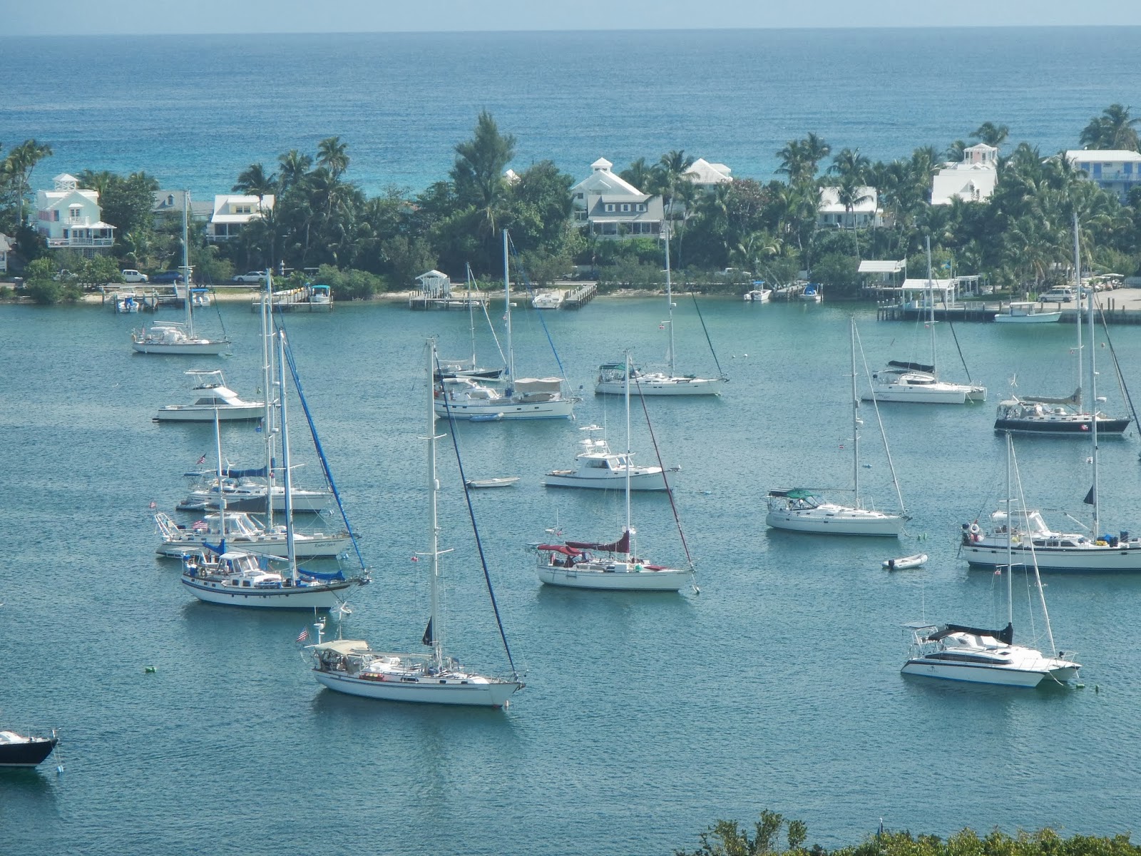
Hopetown Harbour, Hopetown, and the Atlantic beyond, from the Hopetown Lighthouse
Hopetown Harbour -- Aviva dead center/back, green bimini and jib cover
Hopetown -- very narrow, easy to walk across to ocean side for swimming/snorkeling
Hopetown harbor homes and businesses
The streets of Hopetown.  Plenty wide for golf carts!
Ah, the Bahamian colors!! 
The breadfruit tree story
The breadfruit tree
Hopetown, Atlantic beach
Shorebirds running back and forth with the tide -- plovers

Dorothy sloggin' on the blog, also enjoying artist class on the harbor, lighthouse in background

February 11-15 -- Man-O-War Cay

We caught wind of a flea market benefiting the Man-o-War Cay school to be held on Saturday, Feb 15, with vendor tables available -- a perfect outlet for Dorothy's "need for seams"!  Dorothy busied herself making tissue pack covers and fabric baskets.  We sailed on over to Man-O-War Cay, where Dorothy busied herself creating inventory.


Gotta sew -- the need for seams
We anchored off the northwest side of Dickie's Cay and saw a beautiful double rainbow after some showers.
Double rainbow off Dickies Cay
Sunset!!!
We moved down to "the low place," where the island is so low and so thin you can see across it to the Atlantic (can't quite in this photo).  
The Low Place
Fred chilling at The Low Place
The Road to LowPlace

After the inventory was built, but before a big front came through, it was time to move inside to the Man-O-War Harbor.  We had reserved a mooring, but that didn't pan out -- it was gone.  ARG, because we needed to be in the harbor in order to be able to do the flea market.  Fortunately we found another (the LAST) available mooring!

Man-O-War
Time for the flea market -- still strong winds in the morning from the front that passed overnight, but at least it wasn't raining!  The table cloths and items are taped down with double-sided tape.  Dorothy was between a fellow selling an anchor and a woman selling jewelry.  Jewelry proved to be more popular than tissue pack covers, but Dorothy sold enough to feel gratified with this first experience (over $100!).
Dorothy and her wares at the Flea Market
This was FUN!!!


Monday, February 17, 2014

Diving and Hiking - - Exumas

Diving and Hiking   - - the Exumas 

Underwater pictures

Fred has really been enjoying the underwater camera that he received as a retirement gift from the Town of Middlebury - - time to post a bunch of underwater pictures.   Although this particular blog post is mostly about the Exumas, there are a few underwater pictures from the Abacos that this camera was used for:
Off Green Turtle Cay,  Hello, lobster!
Fred went lobster-spearing with Scott, a fellow cruiser (a physician in his other life), whom we met at Christmas time in Green Turtle Cay in the Abacos.  Dorothy gave me a pole spear for Christmas, the type that experienced lobster hunting fanatics like Scott use, and on my first learning snorkel trip with Scott, I spotted the lobster pictured above, and waved Scott over to demonstrate his technique.

This particular lobster was sitting unusually out there -- normally they are much more hidden in or under coral, and all you can see is their antennae.  And, they invariably have a back door to their hiding places.  So, I was advised, one has to spear them in a way that pins them in place, so they don't wiggle out the back door, and then you have to reach in and pull them out by hand.  Gloves and wetsuit arm protection are advisable to protect from coral and nasty barbed antennae....

Scott nails it...

Then he separates the tail, leaving the head section for nearby Triggerfish and others to dine on...
The Caribbean spiny lobsters (called crayfish here) don't have claws or other 'front' parts worth saving.
Scott bagged nearly his limit (9 lobster tails, 10 is the limit) that morning
and our lobster tail became our next meal!  Yum!
Staghorn coral and lots of reef fish off Green Turtle Cay

And, a conch (this one we returned to the seabed) 


Exumas

January 18 - February 5, 2014

Warderick Wells, Exumas, to Lynyard Cay, Abacos

Saturday, January 19 -- Monday, January 20 -- Fully capturing the beauty and interest of the Exumas Land and Sea Park would be a challenge indeed, but we will attempt to share at least a bit of what we enjoyed there.
One of the best features of the Exumas, its terrific Park, established in 1958.

Whale skeleton at Warderick Wells, headquarters of the Exumas Land and Sea Park
Headquarters and staff residence
Exuma Park moorings
We began at Warderick Wells Cay, park headquarters, and we would recommend this to anyone, as you can pick up the park policies and a map of trails and snorkeling spots for each cay in the park there.

We anchored off the west shore for three nights near Emerald Rock, one of the park mooring areas, and used that as a base from which to hike and snorkel.

Emerald Rock
Warderick Wells has some great hiking trails, where you can walk across the island from the (generally leeward) Exuma Banks side (west) to the more exposed  ocean, Exuma Sound side (east). Below is one of the first interesting items we encountered … huge anthills.


Anthill
Also mangroves of multiple varieties, low palms, and sinkholes. One of the trails we walked on was called Boo Boo Hill, not because if you fall you will get a booboo on your knee (which, with the rock worn jaggedy by the ocean surf and spray, you definitely will …), but because at high tide, water coming into blowholes in the rock make a sighing sound, which could be mistaken for ghosts!

Fred at crest of Warderick Wells Boo Boo Hill trail
The crest of Boo-Boo Hill, where cruisers leave their driftwood mementos, the only place in the park where anything may be left...(we did not feel the need to add to this...)
Tuesday, January 21 -- With strong west winds coming, we needed to move.  Happily, there was a park mooring available for us on the other side of the cay -- between Warderick Wells and Hog Cay, providing the western protection we needed.  Also, like many channel anchorages, the boats swung back and forth with the tidal current, sometimes lying 90 degrees to the wind.  To get there, we sailed west from Emerald Rock around a 3 mile long sand bore (sand bar), through the cut north of Warderick Wells from Exuma Banks to Exuma Sound, and down into small channel between Hog and Warderick Wells Cays.  The channel is barely visible - -at the north end of Hog Cay it is marked by a cairn.  Aviva is on the right, below, with the boats pointed north aligned in the strong current of the flood tide, despite a brisk west wind:
Hog Cay moorings, Warderick Wells
Hog Cay's cairn marks the entrance (not so visible from out there...)

There was great hiking here, too, including Pirates' Lair, sinkholes, and rocky coastline.

Cave/ Sink hole -- some are DEEP!
Thursday, January 23 -- We left our park mooring at Hog Cay and sailed into Exuma Sound, a beautiful, close-hauled sail.  Our next planned destination was Bell Island,  but we heard from Guy on Tina that Wyvern III had found it rolly there and so we altered course toward a park mooring at Cambridge Cay, making connection with these friends. We picked up our mooring, and within half an hour we were off with them dinghying to the Sea Aquarium, a wall of coral reef with concentrated fish viewing!  The fish there come to you in droves as you get in the water; clearly they are fed there, park rules or not.  We saw a nurse shark there, as we had a few other places, and a very large southern ray (pictures later in this post). 
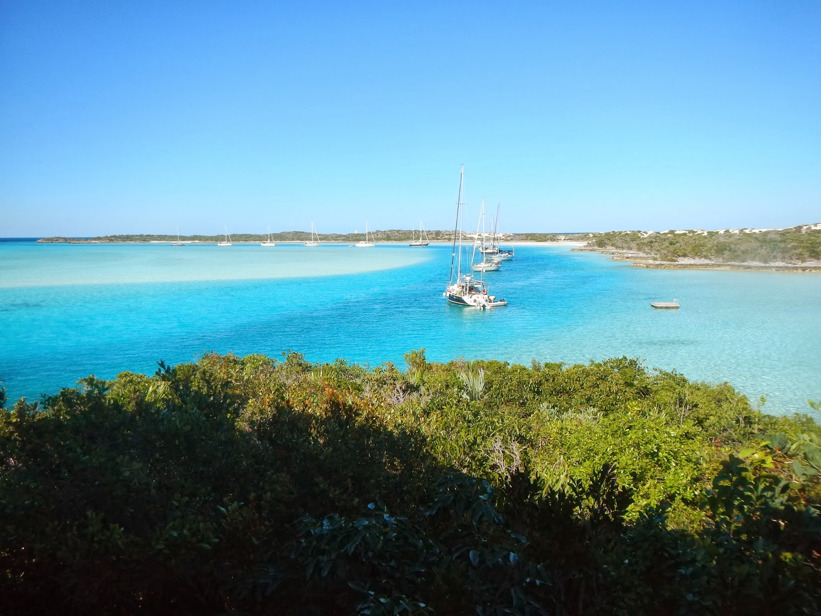
Beautiful anchorage spot (an Exuma Park mooring) at Cambridge Cay...
We went ashore and hiked over to Bell Rock (center).

Bell Rock

The local Cambridge Cay ants,  obviously also inspired by Bell Rock....
curly tailed lizards scurry about

underfoot, layered reef rock, like a topographic map
We snorkeled a plane wreck on the way back to Aviva .... also very interesting:
A 1960's Cessna, reportedly used in smuggling,  apparently missed the runway...
perhaps sampling the goods while flying...whoops...

Then Fred and Dorothy dinghyed off to investigate other anchorages (decided to stay put) and tried to view what we were told was one of Johnny Depp's houses...

Alas, No sign of him or any evidence of pirates of the carribbean type stuff...  However, that evening we got out the DVD player and watched Pirates of the Caribbean in honor of being near (possibly)!

Looking over to Little Halls Pond Cay, a house said to be owned by Johnny Depp?... but no sign of him or other pirate types...

One can't ALWAYS be snorkeling, sailing, hiking, sleeping, eating, planning the next cruise leg, or fixing the boat.  Sometimes ya just gotta completely get lost in a book!
Cruising friend Guy Spencer gave Fred a page turner!  Done in a day...


Our collection of Exumas fish,  coral and snorkeling photos:


Queen Triggerfish

luminescent Blue Chromis


Queen Angel Fish

A Rock Beauty (the yellow and black fish, not the rock...)

Bluehead wrasse

The Sargent Majors at the Sea Aquarium think Dorothy has food (or IS the food...)


From this little guy's tail, looks like he barely escaped a larger fish...youch... 


not sure what this spotted fish was, we haven't found it in the reef fish book...
Blue Tang
Grunts, in graduate school


A Trumpetfish  (the long gray one) and more Blue Chromis


Nassau Grouper season closed.. "we makin' babies..." it says...

(Check out the giant fish lips on these Nassau Groupers...)

An actual Nassau Grouper

 Nassau Grouper, seen from above...
And what the Grouper sees looking up from below...(a Dorothy snorkelfish)


Dinghying out to another snorkeling spot, Malabar Cays

Look closely, there are a few Barracudas  down there...(center).
This was an unusually calm day, and the Exuma Banks water is SO clear...this is 8-10' deep...


Down below, these 5' Barracudas often like to swim near,  and show their teeth, just to unnerve us a bit

giant Starfish
luminescent juvenile yellowtail damselfish - - amidst algae-covered coral

Nudibranch on fan coral

Algae-coated coral - which chokes/kills the coral

the algae coating is said to be a result of global warming

Tuna

Ocean triggerfish

a pair of huge Gray Spotted Rays (off Sandy Cay, Abacos)

Southern ray


Fan coral


Elkhorn


Tube coral


The shoreline:
Typical Bahamas rock shoreline, lace-like, eroded by salt water 

you will want to wear your Crocs walking on this stuff...


Nurse Shark with a Sharksucker (remora) on his back

Shark Suckers hanging out around Aviva's bottom
A pair of Gray Angel Fish

A school of young tunas

A Scrawled Filefish, we think...


Friday, January 24 -- Saturday, January 26 -- With NE winds 14-20 gusting to 22, we sailed from Cambridge Cay, out the Bell Cut into Exuma Sound, because the Banks route took us a longer way north.  Whoo!  It was something out there -- 6' swells!  However, we were only in the Sound the length of Cambridge Cay, Cap'n Dorothy persevered ... then we cut back in at Conch Cut, south of Cambridge Cay, then past Dundas Rock to the Exuma Banks.  From there we had a nice beam down reach to Black Point, our furthest point south in the Exumas.

Black Point's laundromat is reputed to be the best in the Bahamas, and that seemed to be true!  Free internet, too!  BUT -- best put out a stern anchor from your dinghy, to avoid being pushed under the jaggedy rocks at the dinghy dock.  We had been frugal in our dining dollars so treated ourselves to a seafood pizza at DeShannon's, which was very tasty, though I'm not sure exactly what seafood was on it!
Black Point, Exumas
Health care in the Bahamas out islands - a local nurse in the Black Point Clinic

Black Point's excellent "laundermat"   

Our anchorages heading down along the Exumas Cays


Headed back north


We headed back north, stopping at Staniel Cay, where there is a small marina/club and community.  Nearby is the famous Thunderball Grotto, of James Bond movie fame, which is a lovely snorkeling spot:


lots of little fish....

Staniel Cay 


Back in the Exuma Park  - - And more caves at Rocky Dundas, even more cool:


interesting orange lichens-like coral in dark spots, not ever exposed to sunlight...

Rocky Dundas (at low tide)


Compass Cay jacuzzi

At the north tip of Compass Cay, there is a small inlet and rock bar that waves crash through - - at high tide with an easterly swell off the ocean (Exuma Sound),  the result is a big Jacuzzi pool.  Dorothy checks it out:
Compass Cay anchorage
Dinghying up to the bubbly pool -  rock bar ahead

the 'funnel' from Exuma Sound
surge in

Add froth...
And Dorothy gets a Jacuzzi !
Dorothy???   Are you still there???

Hawksbill Cay - hike and boogie boarding

trail to Hawksbill Cay's beautiful east beach
Weathered driftwood

Dorothy is ready!


not huge waves, but good fun...

And here comes Fred ...


Shroud Cay

The last of our Exuma Park stops, Shroud Cay,  a relatively large island with rivers and mangrove interior, rimmed by beaches...
heading up the north river of Shroud Cay

we come to the inlet from Exuma Sound...

and a beautiful secluded beach

Camp Driftwood, the hill where agents spied on drug trafficing to the north on Norman Cay in the 80's


interior of Shroud Cay, flooded mangroves

looking back over the Shroud Cay north river,  Aviva anchored off in the distance (center)

another river head at a beach on the east side of Shroud Cay

Collected ocean plastic debris  -  an unfortunate feature of practically every Bahamian beach

And since we have all this sunny, breezy weather - - -
A day of  airing out the clothes from our lockers


The stops on our way back to the Abacos:

(1)Staniel Cay/Big Majors to  (2) Hawksbill Cay and (3) Shroud Cay,  then to
(4) Roberts /Ship Channel Cay and then two day-passages to (5) Royal Harbor, Eleuthera, and finally to
(6) Lynyard Cay, Abacos - - completing our Exumas whirlwind tour.
Cap'n Dorothy at the helm -- happy and relieved after navigating Little Harbor Cut


'Till next post...